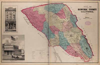
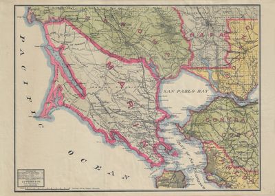
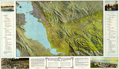
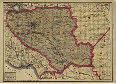
All California Counties
Here are County maps for California. Some City maps are included, in support of their county, perhaps as the county seat. Many examples are N.O.S. from the estate of CF Webber & WS Hutchinson through John P Coll.
Measurements are approximate, From all sources, Governmental & Private Promotional


 Quad")


Display prices in:USD
